By Pattye Volz
Aerial Imaging Elevates the Science and the Education
Common zip ties, chopsticks, and floral tape combine with high-tech software and self-designed flying machines in the impressive drone program CC students and staff have launched on campus and beyond. First field-tested in 2014, the effort already has assisted researchers in assessing the fossil record of dinosaurs in Wyoming and studying the microclimates of tree line vegetation on Pikes Peak — all with computer-programmed, unmanned aerial vehicles.
“This technology is brand new. We are figuring out the details, and it is allowing us to get highly specific data,” said Noah Cutter ’16, a geology major with a minor in computer science. Cutter helped develop the program with CC’s Director of Innovative Technology Matt Gottfried, magna cum laude geology major Jessica Badgeley ’15, and math major Nate Mankovich ’17.
The group’s work started from scratch. “Matt, Nate, and I daydreamed about what we could do, and what we would need to make it happen,” Cutter said, never imagining that they would end up developing a quadcopter, a hexacopter, and a plane.
“I spent a lot of time down in that GIS lab (Geographic Information Systems lab in Palmer Hall) figuring out how to put a drone together, plus finding the right platform — what hardware and software we would need,” said Mankovich, who put his experience to use this summer working with a company that provides images for Google maps.
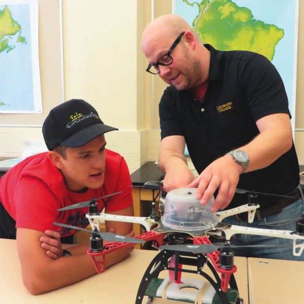
The idea is taking off at CC. “There’s lots of interest on campus in using this for both research and teaching,” Gottfried said.
He and the students designed the hand-built drones to carry a camera for a variety of imaging possibilities useful for very specialized surveying and digital mapping not otherwise readily available.
“You can get this really high-resolution information specific to what you are interested in and collect the data during the timeframes you want,” said Badgeley, the GIS paraprofessional. She worked with the new drones on Pikes Peak in the summer of 2014, and said using a multi-spectral camera allows imaging beyond the visual range, such as the tracking of thermal energy (temperature).
“There is a lot of data available through government labs, from airplanes or satellites but it’s often not at the scale a researcher needs, and some is prohibitively expensive,” Cutter said. “We can get much more meaningful and reproducible information, plus doing it ourselves teaches so much — from electronics and computer science to physics and math.”
Starting from scratch
The team decided six rotors provide the most stability for the CC drones, which are not remote-controlled, but fully programmed and then closely monitored. “We always have someone watching it, ready to switch to manual mode and set it down safely when needed,” Cutter said. Of course, that doesn’t mean things go smoothly every time.
“Some of the most simple things were challenging in the beginning because we didn’t know a small step, but then we would figure it out. We made these drones ourselves, so every time they went in the air you kind of held your breath,” Mankovich said, recalling last summer’s Wyoming trip where they experimented with drones to map existing dinosaur digs and look for potential fossil sites.
And yes, there were some crashes. “But we improvised. Matt was cool. He would say, ‘So, what can we do?’ We found chopsticks and foam in the car, fixed it up, and were able to keep flying,” Mankovich said.
The landing gear gets beat up the most, according to Cutter, who said chopsticks work well for repairs. “We tried lots of different tapes from Scotch and hockey to floral. The floral tape works the best.” He said foam helps dampen vibration on the camera mount and hot glue serves as a waterproof seal. “It may not look great but these field-fixes work,” he said.
Miroslav “Miro” Kummel, associate professor in the Environmental Program, has turned to the drone program for mapping tree crowns along the tree line of Pikes Peak. It’s part of his ongoing research to better understand movement of the high-altitude tree border due to climate change.
Gottfried noted this is the way the program is meant to work — as a support to researchers who want to take this capability further for their own studies. “We have a number of platforms and are developing more. We offer training, and the resource is available for other faculty and programs on campus,” Gottfried said.
“This technology can be very useful to the environmental scientist,” said Kummel. In agriculture, for instance, the right imaging could show when plants are stressed and need additional irrigation or fertilizer. Researchers could monitor natural habitats and track endangered species.
It also could help with post-disaster planning by providing annual mapping of vegetation recovery after fires, floods, or landslides. And Kummel hopes to use thermal imaging from drones to look at heat loss in architecture. “With a 3D infrared image we can calculate the exact heat loss from a building.”
Dreams take flight
Kummel wants a drone readily available so he can “dream up a project and fly the next morning,” as well as allowing his students to come up with their own independent research projects.
Right now, he’s planning to include drone thermal imaging in a Block 4 course, Innovation in Environmental Studies: Applying Drones, Remote Sensing, and Startup Innovations, that he is co-teaching with Patrick Bultema, executive director of Innovation@CC.
Integral to the program is education about operating the unmanned vehicles safely and legally. While debate is ongoing about federal licensing and regulating of drones, Kummel said CC’s activity currently does not require a license but has defined restrictions, such as not traveling over private property without permission or near public roads or power lines.
For Cutter, his work the last two summers using drones to map geologic sites in Wyoming with Associate Professor of Geology Henry Fricke has provided data for his senior thesis. The whole effort has given him direction.
“This is exactly the type of thing I want to be doing. It’s brought together the things I’ve been interested in all of my life, such as computing, technology, Earth sciences, biology, and the environment,” he said.