We exited the exquisite Best Western John Jay Inn in Calexico, CA at 4:40am, just early enough for the previous day’s high of 113ºF to drop to a balmy 95ºF. In the refreshingly ‘cool’ air we departed from the Imperial Valley and headed out to visit our neighbors to the South in Mexico.
At the border crossing in Algodones we met up with our guide for the day, Osvel Hinojosa-Huerta, and his posse of environmentalist cohorts. Osvel, a long-time member of ProNatura, provided us with a wealth of information from the moment we met him. He explained that ProNatura was not only the largest but also the oldest non-profit environmental organization in the country of Mexico, now going on its fourteenth year. Their main objectives are the restoration of the delta area, the education of the public, involvement in public policy, and the purchasing of water rights from the government to put to environmental uses.
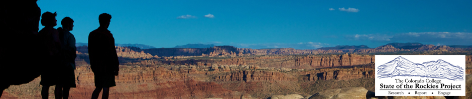
After brief introductions we began our daylong tour of the Mexican Colorado River Delta Region. We began our journey at the Morelos Dam, the only significant structure along the River in Mexico. The Morelos Dam, unlike the Hoover, and Glen Canyon Dam’s of the United States is only a diversion structure. Mexico itself has no storage capacity for it’s allotted 1.5 million-acre feet it receives annually from the United States. Of the 1.5 million acre feet Mexico is entitled to, 90% is delivered through Morelos Dam (the other 10% is delivered via the southern boundary delivery, and unlike the main delivery is not subject to salinity regulations). As a result, all of the flows into Mexico are immediately redirected and put to beneficial use either by municipalities such as Tijuana, or by agricultural water rights holders. The Dam was impressive in that through such diversions it realistically marks the end of the original Colorado River. On one side you see the dry riverbed where water once flowed to the sea, and on the other the recently built canal system that takes water away to where it is needed most. Osvel was quick to mention that any flooding events will result in a release from the dam allowing for the flooding of the traditional riverbed. These events, which occur no more than four to five times a year, constitute the only water that this part of the river will ever see.
Our tour of the Dam was followed by a short drive to the Welton-Mohawk drainage Canal, also referred to as the Mode Canal. The waters passing through this canal system are the made up exclusively of agricultural drainage/wastewater produced by the Welton-Mohawk Irrigation District in Welton, AZ. This water, too saline (typically in the range of 2,500 ppm) and sediment-filled to be productively used in Mexico, drains directly into the Cienega de Santa Clara, an “artificial” wetland because the water is identified as too saline to meet treaty requirements under minute 242. This water is not counted as part of the United State’s delivery to Mexico. At this same stop we were able to walk down into the old Colorado riverbed, now resembling a beach more than a river. As stated before, water no longer flows down this stretch of the river. This did provide an opportunity however, to reflect on what this region must have looked like in centuries past. One could easily envision the prolific riparian environment that once thrived here.
A somber look at what has become was quickly transformed into the realization of what could be at our next stop, Laguna Grande. Laguna Grande is part of a wider conservation, restoration, and education effort currently being pursued by Pronatura and the Sonora Institute in Mexico. The wetlands area land was gained as a concession from the government after the involved groups demonstrated public interest. Water for the land was secured through the collective purchase of water rights by all entities involved in the project. This project is not only providing for the future success of plant and animal species in the area but is being used as a way to open the eyes of the public to the environmental degradation going on in the area.
I have to take this time to remark on the unbelievable heat our group experienced all day long. If I was to exclude this remark you, as the reader would in no way be able to share this amazing experience with us. 115ºF is unlike anything you have ever felt, there was not one person not sweating through his/her shirt by midday. Marco, if you’re reading this blog, these comments are directed at you.
After devouring some of the most delicious fish tacos I have ever had the pleasure of ingesting, we made our way to the last stop on our trip, the Cienega de Santa Clara. The drive into the Cienega is unlike anything most of us have ever seen. It involves a drive through the Colorado River Delta, or at least what is left of it, a barren wasteland unfit for inhabitation by anything save a few strands of hearty and resilient grass. Without the historic flooding events and the natural flow of the river the delta has been transformed from a vibrant wetland to one of the driest places around. Eventually, we arrived at a lush and thriving “desert oasis”. The Cienaga as noted before, was created following the passage of IBWC minute 242, implementing salinity requirements on U.S. water deliveries to Mexico. The wastewater from Welton-Mohawk was so saline that its reintroduction to the Colorado River raised levels to a point where agricultural production was impossible. As a result, a canal was created to deposit the water in the delta area. The water slowly collected over the years and created what is today 14,000 acres of wetlands, now home to 250 bird species, numerous species of fish, and the Yuma Clapperail a protected species in both the United States in Mexico. We were lucky enough to be taken on an hour-long boat tour of the Cienega where we witnessed first hand its incredible biodiversity. We even made friends with a curious pelican whom proved brave enough to swim up to our boat.
After a long, productive, and very fun day, our group, for the first time on the trip, turned North and made its way to Yuma for a little rest and reprieve.
by, Warren King
State of the Rockies Researcher