Greetings from your friendly neighborhood GIS guy!
Online teaching tools are becoming more readily available and are now a permanent fixture in our teaching curriculum. This is no different in the world of spatial analysis and inquiry. The days of plugging away in front of a highend pc in a very complex and comprehensive program is no longer a requirement. One of the biggest advances in this realm is the use of ArcGIS Online, hosted by our friends over at Esri (the creators of ArcGIS Desktop). Not only can you create custom content and publish it online for anyone to use (Mac or PC) but you can also use content and lessons created by others for your classroom activities. They have offered up this service so you can have access to a rich collection of basemaps, demographic maps, image services, and other data. ArcGIS Online gives you an easy-to-use and intuitive work space for collaborating with others in your classroom. Users can create groups and invite others to work together on projects of common interest. Groups can be either private or public, and group members can share maps, data, and other content with each other efficiently and quickly.
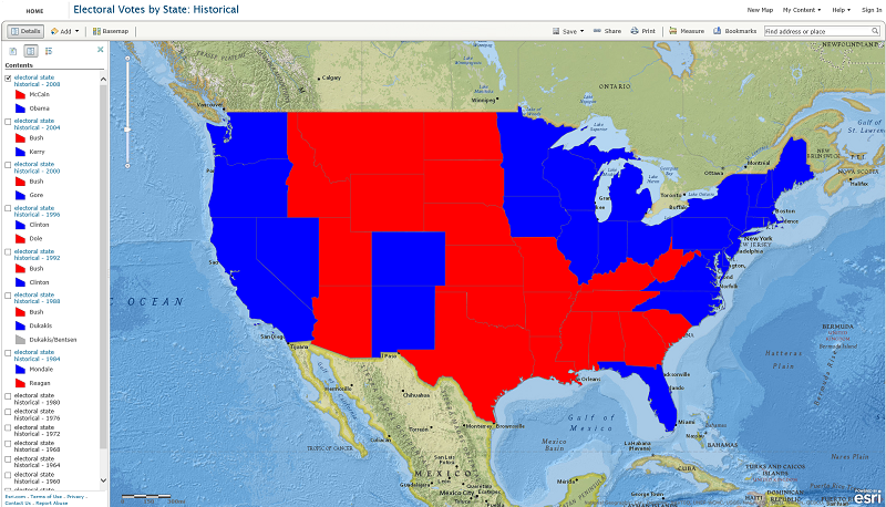
As a prime example of the power and ability to foster discussion and investigation in the classroom by using this spatial tool, Joseph Kerski, Education Manager at Esri, has created an online spatial dataset containing the electoral history for the past 56 years. With the upcoming election this will no doubt aid in the discussion about some of the greater issues that the U.S.A has faced over the years and into the future Joseph’s goal was to foster a platform for interaction, teaching, and the exploration of patterns of our electoral history.
An accompanying lesson is also available available here. This lesson will guide you on analyzing historical electoral votes by state from a spatial perspective using ArcGIS Online.
Any questions or interest you may have for your classroom please feel free to contact me.
Matt Gottfried, GIS Tech. Director. x6130