
Indian Wells Beach, Amagansett, NY
Home sweet home. Amagansett, a small – and I mean small – seaside-town on the southeastern tip of Long Island. While once revered for its placement on the list of “top five eighteenth-century whaling villages that eighteenth-century whalers didn’t know existed”, it is perhaps best known now as a member of a collection of small towns in the area which are referred to together as “The Hamptons”. Every summer, the first week of July through Labor Day to be more precise, my hometown is invaded by vacationers from all over New York and the rest of the east coast. The beaches fill up to the point where large groups of locals picket the parking lots, demanding the young tourists leave and take their “OBEY” snapbacks with them; The roads become almost not worth using from the hours of 11AM-6PM due to the traffic. The vacationers thoroughly enjoy their stay in the quaint villages, in their quaint, modern, beachfront, wooden boxes, and walking down the quaint sidewalks that are slowly erecting more Ralph Lauren, Chanel, and Prada stores by the week.
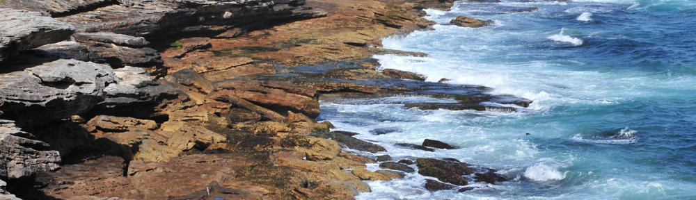
We locals treasure the summer for the weather, but loathe it equally for fear of the throngs. The most troubling issue in being a local and dealing with the summer visitors may be dealing with the occasional look of shock on their faces in being told that you actually live in Amagansett year-round. Yes, that is correct, this town was not just built to host your golf-outings and sunglass shopping. Ok, so some of the town is built for that, and it would probably burn down and be ransacked by Rhode Island if it weren’t for the money that you and your sunburned children spend on sunscreen every summer, but we do other things too. Like surf. Or fish. Or… boat? Not to mention some of our geology:

All typing and painting done by yours truly
When I said Amagansett is on the tip of Long Island, that wasn’t 100% correct. It’s more like Tip Jr. Almost there, so so close, but just one town over. Long Island has a literal tip, with a lighthouse on it and everything. The tip, the lighthouse, and the town built around the both of them, is called Montauk. Montauk, by its own accord, isn’t technically part of the Hamptons, and it’ll probably always stay that way, forever stuck in its, deep-rooted, fishing/clamming-town culture. The most popular souvenir purchased by summer Hamptonites is without a doubt the “THE END” t-shirts sold all over Montauk. Montauk is without a doubt the end now, but it was not always. In fact, for thousands of years following the last ice age, Amagansett was the tip of Long Island.
Long Island was formed through a series of so-called “depositional events” from the Wisconsin Glaciation, a massive sheet of ice that covered a large portion of northern-northern North America. Canada essentially.

Wisconsin Glaciation
It was the debris from the shifting ice sheet that was responsible for forming the early separate land masses that, due to the erosional processes operating in the early Holocene period, eventually formed together and gave birth to Long Island: Capacity 99.5%. It was close, but not yet fully realized.
It must of looked something like this:

That, right there, that’s science
When glaciers shift, consolidations of this glacial debris, called moraines, are left behind on their pathways. However, as it is easily imagined, these ice sheets did not have sediment covering the entirety of their surface areas. These moraines were deposited with gaps in between. These sections, or perhaps just portions consisting of significantly less debris, of the ice-sheets left dips in between higher rising coasts. The sea level was much lower than it is today, and, as such, there was a period during which rather than the dip being filled with nothing but water, there could plausibly have been a strip of much lower-laying land connecting Amagansett and Montauk. This strip could not have lasted for long. As the glaciers began to melt, and the sea levels rapidly rose, that dip was quickly swallowed by the waters. Even if that strip had existed, eventually it would have been entirely submerged in water. So technically, for a time, Amagansett was the tip of Long Island.
So what you got on that, parking-spot thieves?
If the sea had never risen, the dip may have filled in on its own eventually due to erosion processes driven by the wind. But now, with the dip entirely filled with ice-cube melt off, the eroding process would be driven by the water. Eroding sentiments driven by currents from both Gardiner’s Bay – referring to Gardiner’s Island: an island that has been privately owned by the same family for more than one-hundred years, an island, fitting with some of the Long Island “old-money” stereotypes, about the size of four square city blocks – and the Atlantic Ocean, eventually filled in this gap, leaving unique formations (e.g. sand splits, bay mouths) in the land mass that now bridged the faraway coasts of Amagansett, known colloquially amongst the unfortunately-ill-famed, Amagansett born, Ishmael-protege whalers, as “THE END”, and Montauk, a place where people liked to fish I guess.
In present day, this strip is called Napeague, derived from a Montaukett word. The Montauketts were a Native American tribe that resided on the eastern outskirts of Long Island, before the pats sailed over. They were known for walking incredibly long distances, miles and miles of sand dune, to get from tribe to tribe, and also for balling really hard.
The word that gives Napeague its derivation meant “land overflowed by the sea”. So obviously, as far as small strips of land go, Napeague is a pretty interesting place with a really awesome name, and, by association, that proves that Amagansett, and the Hamptons in general, are forever interesting and awesome. And yes, it is possible to live in the area during the winters, no we don’t fear tsunamis, yes there are too many deer, but despite what you might have heard there are no bears or land-sharks. So there’s no need for that look of surprise on your face.
But Napeague is still just basically 11.5 miles of stuff no one really cares about.
Works Consulted:
http://dspace.sunyconnect.suny.edu/bitstream/handle/1951/47770/DUBECK00.pdf?sequence=1
http://people.hofstra.edu/J_B_Bennington/research/long_island/li.html
http://www.zonu.com/fullsize-en/2009-11-09-10972/Wisconsin-glaciation.html

![]()