
by John McCormick ’14 and Joe Grimley ’13
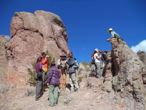
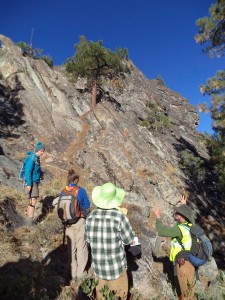
This week our geological journey brought us to McKissick Canyon, where the paleovalleys filled with “auriferous gravels” (these yielded phenomenal quantities of “placer gold” in the 1850’s) are only outdone by the volcanic deposits that blanket the landscape for hundreds of kilometers.
The pyroclastic volcanic rocks, filled with blocks of rock that were blown up in catastrophic eruptions and entrained in the flows, originated in volcanic centers in Nevada and funneled into paleovalleys that carried them far to the west toward the Pacific Ocean. As we surveyed the outcrop and made our observations, we painted a picture of what the Sierra Nevadan landscape used to be like millions of years ago…
As our expedition progressed, so did our understanding of the geologic history for the Sierra Nevada mountain range. The rocks of the Sierra Nevada preserve a record of a succession of dynamic geologic events that help us to reconstruct the topography of the past. Stages in the mountain evolution, illustrated in the sequence of paleotopographic profiles below, include:
1) initiation of the volcanic arc in oceanic setting, later to be accreted to North America (displayed by early phases of the SN batholith complex)
2) Subduction of the Farallon Plate/ establishment of the Sierra Nevada Batholith complex as a continental margin arc (intermediate plutons of the Sierra Nevada Batholith)
3) Flattening of the Farallon oceanic slab/ Formation of the Nevadaplano (evidenced by isotopic information relating to paleoelevation)
4) Roll back of the Farallon Plate/ ignimbrite eruptions and volcanic rocks
5) Segmentation and subsidence of the Nevadaplano to form the Basin and Range (based on oxygen isotopes from calcite and smectite)
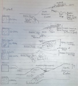
The Cenozoic rocks reveal the presence of a dramatic high-elevation region — an orogenic plateau named the “Nevadaplano” — that far surpassed the present-day Sierras in areal extent and elevation. Big rivers flowed from this region, carrying the auriferous gravels, and large, violent eruptions emanated from volcanic centers in this region. Based on the current topography of the North Sierra Nevada Range, the plethora of rocks within, and geochemical isotope data, we reconstructed a model and understanding of the paleotopography of the region dating back to 200 million years ago.
Along our educational journey, we still found moments to relax and unwind in Buckeye hot springs, nestled between a dripping travertine mineral deposit and a cold mountain stream.

And, to have a little fun at Serene Lake playing ultimate Frisbee.
The paleotopography of the Tahoe region is only a small fraction of the overall development of the Sierra Nevada Range. As we explore several more sites in the future, we will puzzle together the processes and features that composed the paleotopography of the Sierra Nevada Range.
Beautiful pictures! Thanks for sharing your trip!