Several professors at CC incorporated parts of the 18,000-acre Waldo Canyon wildfire area into their coursework during the fall semester.
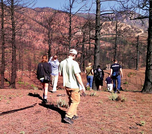
Eric Perramond, associate professor of Southwest Studies and Environmental Science, took his Political Ecology of the Southwest class to the burn site during Block 1, barely nine weeks after the fire raged on the west side of Colorado Springs.
Originally Perramond had designed the course around a different theme, but after the fire, he changed the focus of the course, opting to concentrate on the political-economic factors of fire ecologies. Students taking the course gained an appreciation of how fire and pyrogeographies can substantively change landscapes and livelihoods, as well as personal lives, in the Southwest and in Colorado.
The 21 students in his class, the majority of them environmental policy majors, saw firsthand how a series of factors, from zoning to forest policies to building in the wildland/urban interface, combined to produce the hazard ecology of the Waldo Canyon fire. “They saw that there is not just one reason — one explanation — like climate change or zoning for a disaster like this. There are a multitude of interconnected reasons,” Perramond said.
Geology Professor Christine Siddoway led a geology course, Fundamental Methods and Rocky Mountain Evolution, into the Blodgett Peak Open Space in northwest Colorado Springs during Block 2. The areas they were looking at were moderately to severely burned, and as a consequence, the housing developments downslope of the burn areas suffered from debris flows during rains later in the summer.

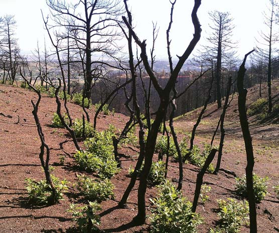
This photo, taken about nine weeks after the fire, shows the gambel oak already starting to come back.
Siddoway’s class undertook digital mapping using high precision GPS instruments to chart the location of trees, log dams installed to slow erosion, and debris flows that jeopardized homes and streets. They also classified burn severity and documented vegetation responses. The data gathered using GPS in the field was brought back to CC for development of a Geographic Information Systems (GIS) database. Using resources of the Keck Geospatial Commons, one of CC’s academic technology centers, the new data were integrated with a variety of base maps that were used for landforms analysis. This will provide a basis for additional visits by Siddoway’s future geology classes, thus allowing for the monitoring of longer term consequences of fire. It will also help measure and document the vegetation response and recovery of the area over time.
In addition to the classes that are studying the burn site, four students are working with CC’s Collaborative for Community Engagement to help with the Waldo Canyon restoration efforts. The students, including team leader Erica Sarro ’13, as well as Andrew Allen-Fahlander ’13, Edward Crawford ’14, and Dylan Sondermann ’15, have created an interactive map that allows officials to track restoration progress for residences and neighborhoods in the burn area.
The GIS map is being used by Colorado Springs Together, a community-wide volunteer effort to restore and rebuild the fire-ravaged neighborhood. CC students visit the site at least every other week, sometimes more often, photographing progress and posting updates to the map. Map users can roll over an area and find a photo and details of each individual home site.
Sarro, an environmental science major from Pleasantville, N.Y., joined the project because she wanted to reach out to the Colorado Springs community. “Sometimes I feel I live at CC and not in Colorado Springs. I wanted to be more connected to the people here,” she said. “I think it’s important to engage where you’re living and engage with the people around you.” For more information go to: http://2cc.co/WaldoCanyon
— Leslie Weddell
